
Following the adoption of the first district-wide plan for Whakaraupō Lyttelton Harbour and Koukourārata Port Levy, the Christchurch City Council has confirmed that the next areas for coastal hazards adaptation planning are the Lower Ōpāwaho (Heathcote River) and St Andrews Hill to Taylors Mistake.
The Coastal Hazards Adaptation Planning (CHAP) programme, led by Christchurch City Council in partnership with local communities, is intended to help residents understand future risks and identify practical responses that can protect people, property, infrastructure, and the environment. Rather than reacting to emergencies as they occur, the programme encourages communities to plan ahead, creating greater certainty and resilience for future generations. Understanding future risks involves some degree of forecasting: the report, Under pressure: Climate Change and the Ōpāwaho heathcote River Catchment published by the Ōpāwaho Heathcote River Network in March 2026, endeavours to provide useful information about likely climate change senarios for the catchment.
Some Christchurch communities have already experienced flooding, while increased erosion, storm surges, and rising groundwater is anticipated and likely to be more severe over the coming decades. Coastal adaptation planning provides a structured way for communities to consider what these changes may mean and how they can respond over time.
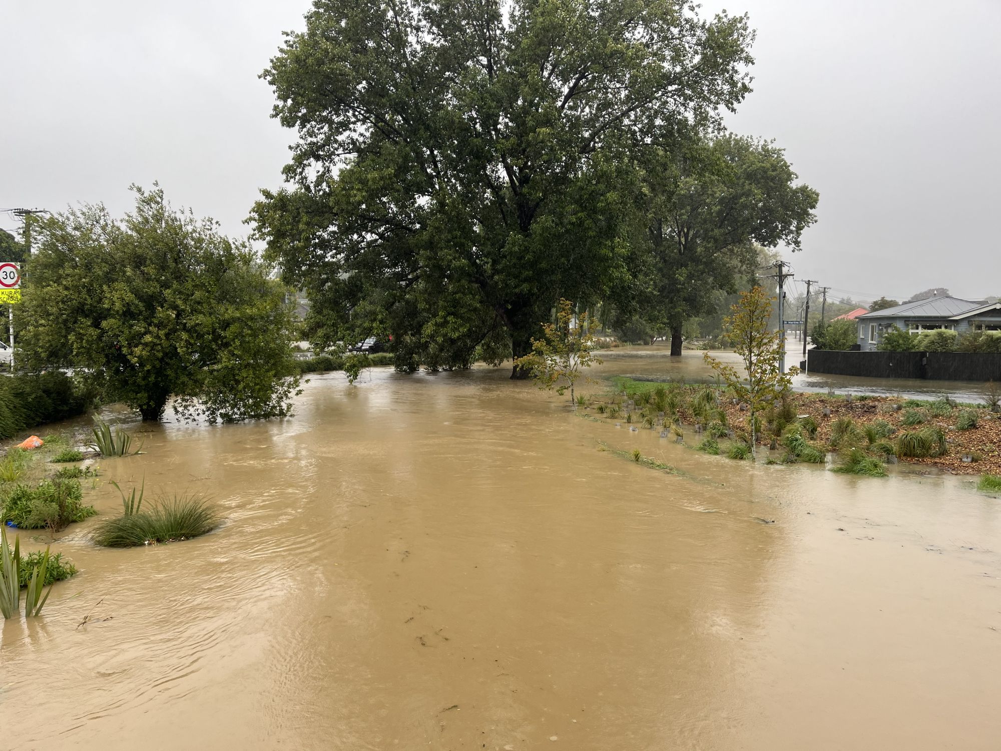
Riverlaw Terrace at Ensors Road, February 2026. The adaptation planning will extend upstream to this point.
For residents, one of the greatest benefits of CHAP is the opportunity to help shape the future of their own neighbourhoods. Through workshops, community conversations, and local advisory groups, residents contribute their knowledge, experiences, and aspirations. This ensures adaptation plans reflect the unique character and values of each community rather than relying on generic solutions.
Examples from Whakaraupō/Lyttelton Harbour and Koukourārata/Port Levy adaptation planning show how this approach can deliver practical outcomes. In Whakaraupō, communities explored options such as strengthening natural coastal buffers, improving the resilience of key infrastructure, adapting public spaces, and planning for longer-term changes where risks may become too great to manage. Residents were able to weigh the advantages and trade-offs of different approaches and help identify preferred adaptation pathways.
In Koukourārata, the planning process highlighted the importance of maintaining access routes, protecting essential services, and recognising the cultural significance of the area. Engagement with mana whenua ensured that cultural values and mātauranga Māori were incorporated alongside scientific assessments. For local residents, this created a clearer picture of how future decisions about roads, facilities, and coastal management might be made.
The programme also highlights the value of working with nature. Restoring wetlands, protecting coastal margins, and enhancing native vegetation can help reduce flood risks while improving biodiversity and recreational opportunities. These nature-based solutions often provide multiple benefits for communities, supporting both environmental health and public wellbeing.
For homeowners and businesses, adaptation planning offers greater clarity about future risks. Access to reliable information allows people to make more informed decisions about property maintenance, investment, insurance, and long-term planning. While uncertainty can be challenging, understanding likely future impacts helps communities prepare gradually rather than facing sudden disruption.
Another important benefit is the protection of essential community assets. Roads, wastewater systems, stormwater networks, parks, reserves, and community facilities are all vital to daily life. Identifying vulnerabilities early allows councils and communities to prioritise investments that strengthen resilience and reduce future costs.
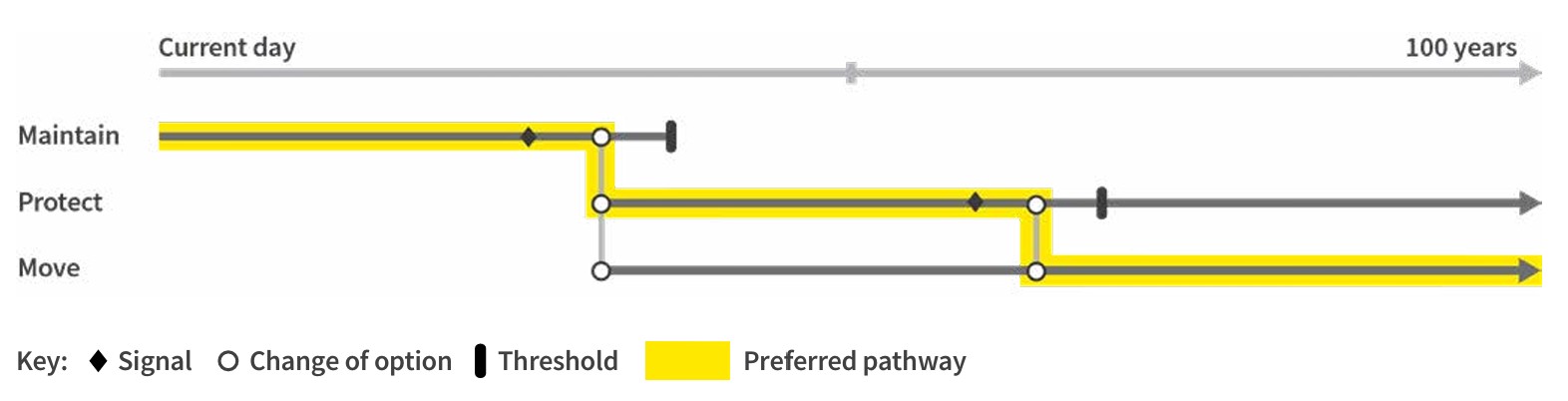
Diagram of a theoretical adaptation pathway: signal indicates that planning is required to start; trigger indicates it is time to act; threshold is an end line in the sand.
Proactive planning can also reduce the long-term financial impacts of coastal hazards. Flood damage, emergency repairs, and infrastructure replacement can place significant pressure on households and local authorities. By planning ahead and implementing adaptation measures progressively, communities may avoid larger costs in the future.
Importantly, adaptation planning is not only about infrastructure. Coastal communities have strong social connections, shared histories, and deep attachments to place. The CHAP process aims to preserve these community strengths while helping residents prepare for environmental change.
As a lead-in to the coastal hazards adaptation planning process for the Lower Ōpāwaho (Heathcote River), the Ōpāwaho Heathcote River Network has invited the CCC coastal hazards adaptation planning leadership team to speak at its AGM on June 25th. It promises to be an interesting introduction to the whole planning process.