Woolston Walk

This is a short walk to invite you to discover some of the historical and natural treasures of Woolston, a suburb that has played an important role in the development of the city of Christchurch.  The circular walk will take about one hour and follows along both sides of the Opāwāho/Heathcote River.  The starting point is the Christchurch Quay located on the corner of Richardson Terrace and Ferry Road, but you can join the walk at any place along the route.

Click each number on this map to discover information about what used to be here, or still is.  On the ground at each location you will also discover a marker that has a QR code which will also take you to this information.


This walk was prepared for you by the Laura Kent Reserve Workgroup, a volunteer group which is part of the Opāwāho Heathcote River Network. The workgroup meets on the first Saturday of every month, 9.00-11.00am to act as kaitiaki of this area.

blank Trees and Flora

The kaitiaki of the reserve have tried to plant native trees and shrubs that would have naturally occurred along the river and have named some of them with their Māori names. See if you can find 7 common trees and shrubs Tī Kōuka, Harakehe, Horoeka, Ngaio, Tōtara, Tarata, and Karamū. Click on image to enlarge.

blank

Tī Kōuka (cabbage tree)

blank

Harakeke (flax)

blank

Horoeka (lancewood)

blank

Ngaio

Tī Kōuka …The tough fibres of the leaves were traditionally used for weaving baskets, making rope and string, and even making sandals. The taproot and lower stem are rich in fructose and were a valuable food source.

Harakeke… Found all along the river it was an indispensable plant for Māori. Outer leaves were used for weaving. The fibre found in the long leaves was used to make rope, fishing lines, and nets. Medicinal uses of different parts of the flax plant were many. Early European settlers found there was a market for flax because it was so strong, and it became one of Aotearoa’s first primary exports.

Horoeka… with its unique prehistorical look this tree has an interesting transformation. At about 20 years of age the long spear like leaves change to shorter more conventional leaves and form a more bush like cluster. Branches of horoeka are often straight and make good walking sticks.

Ngaio…. You can pick a Ngaio tree from its leaves. Often a light olive green in colour they have tiny spots or oil glands all over them. These contain a toxin which is a deterrent to biting insects like namu (sandflies) or waeroa (mosquitoes). A handy plant to recognise when you have forgotten your repellent!

Tōtara…One of the tall trees of Aotearoa it often symbolises strength and goodness. It was prized for building canoes, and early Europeans discovered it was a very hardy and long lasting timber even in the ground. Many Tōtara were sawn down to build the early buildings of Christchurch. You can often pick Tōtara because its short little leaves are prickly to touch and its stringy bark.

Tarata… When crushed the leaves exude a strong scent of lemon, which explains its common name as lemonwood. It has beautiful yellow flowers and if you walk by on a still warm night you will small a sweet fragrance.

blank

Totara

blank

Tarata in flower

blank

Karamū

Karamū… The red berries of karamū are eaten by many birds including the korimako or bellbird. They also have been a food source for Māori. You could try harvesting the little seeds to make a cup of coffee as the tree is of the same genus as coffea aribica.

So maybe that’s the note to end this little journey on. Find a local café and digest what you have learned about this rich part of our city!

blankLaura Kent Reserve

blank

Laura Kent Reserve in 2020

Welcome to one of the few places in Christchurch named after a woman.

Laura Kent, aged two, arrived in Christchurch with her parents Rhoda and Edward in 1851. Edward was promised a position at the College proposed to be built by the Canterbury Association but before this was established he took up farming. However, he died in 1855 aged 35. His wife, Rhoda, remarried Henry Peel and agitated for the building of Radley Bridge.

Two daughters from the first marriage are remembered in the area. Annie married a Mr Tavender and is remembered in a nearby street name. Laura did not marry but lived on in the farmhouse located nearby until her death in 1925.

blank

Laura Kent Reserve in 2017

Laura’s obituary states: "Miss Kent possessed two very marked tastes- for music and for flowers. In her youth she was a member of the Mendelssohn Musical Society, and was also a member of the choir of St Mark’s Opawa, for over 50 years. She took a deep interest in the parishes of Opawa and Woolston with both of which there were strong family associations. Her love of flowers was intense, and the grounds of “Radley” were always a joy to the beholder."

This reserve, originally part of the Radley Farm, would have been well known to Laura, and no doubt she enjoyed the birdsong and peace of the area.

Since 2017, the reserve has been adopted by a group of volunteers who continue to work as kaitiaki or trustees/guardians of the reserve. A range of native plants that may have been found historically in the area have been planted to encourage the natural flora and fauna. Views to the river and a safer environment have been created. Take a moment to stop here and listen and let nature speak to you. It is a place of peace, te wahi rangimarie.

blank

Radley Park and Roimata Food Commons – an inspiring story to tell

blank

Radley Park including the Roimata Food Commons

The lower Opāwāho/Heathcote River and estuary was part of the food gathering resource for local Māori.

Originally the land surrounding the river was swampy and covered in scrub, grasses, flax, sedge, raupō, and trees. For Māori the river provided a food source and was an important path though the swamp. Many travelers crossed these waterways in simple hollowed out canoes or in mokiki, reed canoes. They practiced Mahinga Kai, looking after the natural resources that you live alongside guided by values of Kaitiakitanga (stewardship) and Manaakitanga (respect) for the whenua (land), awa (river), rākau (trees), ika (fish), manu (birds) and all other living beings.

Sadly as we have seen, the industrial focus of the early European settlers saw the river and its environs treated as a resource to be used, and as a sewer to dump waste. With a significant increase in human population, these issues magnified and impacted the river and its environs.

The park in which you now stand was not used for industrial purposes. In the late 1840's, during the early European settlement of Ōtautahi/Christchurch, rural section 64 (comprising of 130 acres of land) was purchased by Edward Kent and Issac Luck. They set up a farm named originally Isis Farm, after the river flowing through their hometown of Oxford England, and grew crops of wheat, oats and turnips. The farm was later renamed Radley Farm.

blankThe land was passed onto the Christchurch City Council in the mid-1950's by the then owners Alfred & Hannah Gates as part of their estate settlement. A large portion of the farm was used for housing, but the Gates had stipulated that a portion of the land was to be kept for the wellbeing of the community...hence the creation of Radley Park.

In 2017 a trust was formed to establish the Roimata Food Commons and Community Garden. Over 100 heritage fruit and nut trees, 1000+ native plants, herbs, berries, vegetables, flowers and perennial plants have been planted. Two Food Forest areas, a mixed fruit garden, four native plant clusters, and more recently a community gardening/gathering space have been created. This initiative also seeks to restore the practices of Mahinga Kai.

blankBirds in the water

blank

Pāpango (New Zealand scaup)

One species of duck that is common along this stretch of river is the cute little New Zealand scaup or pāpango as it is known in Māori because of its dark colour. They are smaller than other common ducks, are coloured dark brown and black, and dive under the water for food.  They may submerge for twenty to thirty seconds and travel to depths of three meters looking for aquatic plants, small fish, water snails, and insects.

Often there are small groups of pāpango.   You can pick the males because they have darker plumage and have a distinctive bright yellow eyes.  They are quite sensitive to humans and animals like dogs and will keep a safe distance, unlike other ducks who are often looking to be fed.

Pāpango are found throughout New Zealand.  They nest from October to March. The newly hatched ducklings begin diving for food on their first outing.

blank

Pied shag (kāruhiruhi)

Shags are another common visitor to this part of the river as they search for food.  All shags dive and swim underwater to catch fish, crustaceans, and insects. Usually, they are seen as isolated individuals, but occasionally they will be seen working as a group.  Often they will stay underwater for 20 seconds or more and swim some distance from where they disappeared.  They surface for a few seconds then dive again so you have to watch hard to see them.  You may see one surface after their underwater swim with a small fish or young eel in its mouth.  Sometimes these catches are quite large and the shag has some trouble swallowing the catch!

Although they look similar there are different types of shag distinguished by size and patches of white plumage.  The most common shags you might see are little shags (kawau paka), and larger pied shags (kāruhiruhi).  Both will have varying amounts of white plumage on their fronts.  Occasionally you might see a black shag.

blank

White faced heron or matuku moana

Often seen alone on their long slender legs close to the shore as you look downstream along what is known as “the cut” will be a white-faced heron or matuku moana.  These large grey birds with white faces wade slowly close to the edge of the water looking for small fish and other food like crabs.  They will often stand completely still as they look for prey and when they move, notice how little they disturb the water.  Once food is seen, they strike with lightning speed to grab their prey.

They appear very graceful birds but their call is a rough guttural squawk. They are actually a fairly recent arrival in New Zealand having become established naturally in the mid 20th century.  They are now widespread.

blankThe Woolston Cut – on the control gate bridge

blank

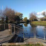
Look down the Woolston Cut from the Barrage

The Opāwāho/Heathcote River takes a sharp right-hand turn as it flows downstream at this point to flow around what is known as the Woolston Loop.  In the 1980’s it was decided to build a bypass to this long loop of the river to increase the amount of water that could be evacuated in times of flooding.

The concrete sided channel that you can see as you look towards the hills downstream (510m in length) was dug to allow water to flow directly out to the estuary instead of travelling around the long loop which takes you past the Tannery.  The cost for the project was two million dollars.

blank

The Woolston Cut - note the concrete walls on the sides

However, once built there were environmental issues.  Allowing water to flow more easily to the sea also allowed seawater to travel further upstream causing bank destabilisation and the death of trees.  The saltwater changed the soil cohesion, which was compounded by the activities of a burrowing crab that had migrated further upstream.  Tree death was also occurring from the increased saline conditions.

The solution adopted was to install large control gates that can be shut most of the time but opened in times of flooding.   Normally the river will flow around the loop, but in times of potential flooding, the gates can be opened to release excess water quickly through the Cut.

blank

Dredging silt from the Cut, 2020

Lessons learned
The Woolston Cut experience brought engineers and ecologists together.   We learned that rivers are complex networks of life.  Tampering with the natural flow of the river had all sorts of consequences.   Flooding issues for Christchurch remain.  Uplift from the 2011 earthquake at the mouth of the Opawaho/Heathcote River has potentially reduced flow into the sea, as does sea-level change.   Climate change has also increased the risk of heavy rainfall.
More emphasis has now been put on the storage of water upstream in times of flooding to reduce peak flows, and greater care is being taken to manage the river considering the ecology, landscape, recreation, heritage and cultural values.


blankUnion Wharf - timber for a new town

blank

The marker indicating the original position of Union Wharf

Union Wharf was also known as Millton’s Wharf and was built principally for the coal and timber trade.  Part of this wharf may have been used by the Thackers of Okains Bay to land their timber.

blank

Lyttelton Times, Saturday, 8th December, 1860

Four notable Captains lived in Woolston with their families.  They were Captain Buxton, Captain Louis Marquet, Captain Christian, and Captain Charlesworth.

Captain Buxton had won the government reward of five hundred pounds for taking his boat successfully across the Greymouth Bar on the West Coast to bring supplies from Lyttelton to the gold diggers there.

Captain Marquet made regular calls at this wharf with his 20-ton ketch Margaret with timber from the peninsula to serve the booming building industry in the city.  A friend with a strong draft horse helped tow his ketch around Humbug Reach (also known as the Devils Elbow) at the entrance of the river into the estuary.  This stretch was always difficult with the prevailing winds and tides.  As soon as the vessel was tied up at the wharf the friends would walk over to the hotel for refreshments, not forgetting the horse, which was rewarded with a bucket of beer.

blank

Union Wharf (date unknown)

blankLooking in the Water

blank

Go down onto the jetty

The Mysterious Story of Tuna

blank

Long-fin tuna

If you had some spare cat food and dropped some off this landing into the water, you will probably see a mysterious eel, or tuna as known by Māori, emerge to gobble it up. If it were at night time there would probably be a collection of bodies as they prefer darkness. In the stretch of river you can see, there may be over a hundred eels or tuna. Most will be short-finned but there may be some endangered long-finned tuna. They both have an amazing life journey.

Born over 2000km away …
Short-finned eels, like their long-finned cousins, start and end their lives in the sea. Their birthplace is over 2000km away somewhere in the deep ocean between Fiji and Tonga. Adult females lay between one and three million eggs which, if fertilized, will develop into very small leaf-like creatures. Carried by currents, some fifteen months later they change into tiny transparent glass eels which look a little like whitebait or inanga. Swimming off our coastline these eels sense sources of fresh water. Finding rivers to swim up, they develop a dark colour and grow a gut for the first time. At this stage, they are called elvers.

blank

The life cycle of tuna

A place to call home …
The elvers migrate up rivers travelling mostly at night during springtime. They find a place to settle, like this area of the Opāwāho/Heathcote River where they may grow up to a metre long and can weigh up to 3.5 kilograms. They are great scavengers for food. Their skin is thick and leathery but actually has scales embedded in it. If you catch an eel you will quickly discover there are slime glands dotted all over it making it very slippery!

Time to breed and die…
When male short-finned eels are about fourteen years old, and females about twenty-two years, they get the urge to breed. They eat their last meal and their guts begin to shrink away. Their fins grow larger, their eyes almost double in size, and they head off downstream usually between February and April, on the darker nights. Sometimes the migrating eels gather in solid squirming masses near the mouths of rivers. In former times, these were important places for Māori to harvest eels for food supplies.  Swimming over 2000 kilometres northwards to their spawning ground, the females release their millions of eggs which are fertilized by the males, and then the parents die.

Traditional kai
For local Māori, short-finned tuna was a significant food resource and this area was a traditional food gathering site. Māori had extensive knowledge of the ecology of eels and harvested them through a variety of techniques.  Today short-finned tuna are reasonably plentiful as they survive well in polluted waters, but long-finned tuna need better quality water and numbers are in serious decline.

Inanga/whitebait – this is a very important area for spawning

blank

Inanga eggs

Eggs are laid on land
A few days before a full and new moon from February to May, inanga migrate from upstream to this special area of the Heathcote/Opāwāho River. Inanga only lay their eggs in this part of the river where fresh water and sea water mingle. Eggs are laid on a spring tide which is a special big tide.

Shoals of inanga work their way along the bank, pushing into the vegetation at the high tide level. Each female can release up to 13,000 eggs, which are about 1.2 mm in diameter. The males can turn the water milky as they fertilize the eggs.

After the tide goes down, the eggs are hidden at the base of the grasses which are now out of the water till the next big spring tide. The grasses protect them from dehydration, extremes of temperature and damaging UV radiation. When the water of the next spring tide reaches the eggs they are stimulated to hatch and are carried downstream to the sea where the tiny larvae grow quickly, feeding on plankton in coastal waters for 6 months.

blank

Inanga (Galaxias maculatus) whitebait

Whitebait return
By spring the juvenile fish have grown to about 55 mm in length and start to migrate back into rivers and streams. During this migration, they are called whitebait. Those that escape the whitebaiters’ nets spend the summer upstream growing into adult fish (inanga). They grow to 8–11 cm in length and by late summer most inanga are mature and ready to spawn. Many fish die after spawning but some live on for another year.

The Polluted Water

As you look into the river you will observe it is not crystal clear. Shortly you will walk over the barrage bridge and observe some of the rubbish in the river that accumulates here. It wasn’t always like this.  In recent years the water quality has improved a little but we have a long way to go.

Industries can no longer discharge all their waste directly into the river but people still throw rubbish and garden waste into the river, and in our city we allow water to wash off our streets into gutters and into the river.

The brake pads we use on our cars release metals like copper into the river. Duck poo and dog poo often ends up in the river. We empty all sorts of chemicals into our stormwater drains and these chemicals find their way into the river.

Poor planting and development practices mean we allow all sorts of sediment to wash into the water, and measurements of nitrate levels are very high. If you look amongst the grasses by the river where the inanga spawn you will find all sorts of plastic and other rubbish.

The Opāwāho/Heathcote is one of the most polluted waterways in our country! When Europeans first came here they played in the water and drank it. Until recently there were annual raft races in the river. Now it is not safe to play in this water, and certainly not drink it.

Wouldn’t it be wonderful if we could push reset and treat the river as a source of life rather than a convenient drain.  The tuna and inanga, and our mokopuna (grandchildren) would say a big THANKYOU!

blank

Langdown’s Wharf – two lime kilns operated close to this wharf

blank

Only this marker indicates where Langdown's Wharf used to be.

The different wharves along the Heathcote are linked with a diverse range of industries.

William Langdown owned two lime kilns beside the wharf that he built here. Limestone was heated in the kilns to produce quicklime and lime putty which was used in the tanneries located in the area and to make mortar used to lay bricks in the burgeoning township of Christchurch.

blank

This photograph was taken near here about 1880. It shows Captain Messervy about his vessel “Minnie”. Across the river is a farm house at Radley Farm.

Limestone chip was quarried and put in bags in the hills above Amuri Bluff near Kaikoura. The bags were then loaded onto small ships for the trip south.

Langdown had purchased a 30-ton schooner (sailing vessel with 2 or more masts) called the Bee to make weekly trips bringing back 40 tons per trip.

Getting the limestone onto the vessel without the protection of a harbour was no easy task, and tragically the Bee was lost with all 6 crew members in a storm at Amuri Bluff in 1881. Such tragedies were all too common.

blank

Aikman’s Wharf – servicing a woolscour and the importance of Raupō

blank

Aikman’s Wharf with the grain store visible (Date unknown)

blank

This marker memorialises the position of Aikman's Wharf.

Originally Navigation Street connected this wharf with the Ferry Road which was a main artery into the new town of Christchurch.  This wharf was built chiefly to service a nearby woolscour.  The wharf run by Sandy and Colin Aikman, auctioneers and general agents, and served as a collection point for wool bales brought in from Saltwater Creek, Kaiapoi, Gore Bay, and Banks Peninsula to the wool scouring works located on the motel site of today.

Later a bonded warehouse was also built adjacent to the wharf, the first to be built in the area outside of Lyttelton.  This enabled goods that attracted an import duty to be stored until the duty was paid and the goods released.  It was also capable of storing 350 tons of grain.

In December 1860 W Stroud the Master of the schooner Dauntless was advertising he would take freight or consider a charter to anywhere in New Zealand, sailing from Aikman’s Wharf.

Raupō

blank

Raupō reeds

blank

Freight advertisement, Lyttelton Times Dec 8th 1860

Nowadays, you can see a stand of raupō reeds growing at the water's edge.

Raupō stalks were traditionally used for thatching walls and roofs of whare and storehouses. The down from the seed head was also used to make mattresses to sleep on. Dried leaves were traditionally used to make a covering for poi which were also filled with the raupō down, and to make canoe sails and kites.

Bundles of stalks were used to make small canoes (mōkihi) and rafts to facilitate water travel and the starchy rhizome root was a food source along with the profusive yellow pollen which was baked into a sweet cake.

blank

This sketch by missionary Richard Taylor shows a Māori crossing a river on a raupō mōkihi, probably in the 1840s

blank

Radley Street Bridge

blank

The current Radley Street bridge, the second one on this site.

You are standing on what is the second Radley Bridge on this site, built in 1930.  These days we take bridges for granted but before bridges were built, rivers like the Ōpāwaho Heathcote were major impediments to movement.

blank

Radley Swing Bridge -1927 (photo Christchurch City Council)

In 1880 there was no bridge and local resident Mrs Peel (formerly Mrs Kent, and Laura Kent’s mother) of Radley Farm, offered to pay most of the costs of the first bridge on this site. 

The iron bridge was locally built by  Anderson Bros who had established a local foundry and cost 675 pounds.   It was a swing bridge, pivoted from a pier at one-third span, to allow small boats to access Christchurch Quay.  Modern vehicles may have struggled to cross it, as it was only 3.66m wide!  The opening was reported by the Lyttelton Times on 25th October 1881 as you can hear ...

Take a moment to savour the view downstream.  Thank you Mrs Peel for your foresight and commitment to do something for your community!

Downstream 150m you will find another wharf marker.


blankChristchurch Quay – also known as Montgomery’s Wharf

blank

View from current Christchurch Wharf

Welcome to the Opāwāho/Heathcote River. Māori had two names for different sections of the river. O Hika Paruparu (the muddy fishing place) for the river in the estuary region, and the O Pā Wāho (the outward or seaward Pa) for this section flowing through Opawa where a small settlement was located. Early Europeans named the river the Opawa, the Serpentine, and finally the Heathcote. Sir William Heathcote was a member of the Canterbury Association.

The early European in the new settlement of Christchurch faced a problem. How could they get goods landed in the port of Lyttelton to the new settlement of Christchurch? Timber and other building products from Banks Peninsula also needed to be supplied to the growing town. Because there were no roads and tunnels the solution was to bring goods by smaller boats around to Sumner, across the bar, and up either the Heathcote or Avon Rivers. Because of its depth, the Heathcote became the preferred choice.

Christchurch Quay was the first wharf to be built along the Heathcote River, sited as far upstream the small boats could navigate. Built in 1851 it was soon joined by other wharves constructed just downstream. Personal belongings for new settlers, huge amounts of timber to build the new town, and other imported goods were brought up the river to be unloaded. At its peak fifteen vessels docked in a day to unload and load cargo here.

JW Smith of Sydenham reminisced: “Once you would see quite a dozen traders in various parts of the river or alongside the wharf. Luggage and goods were taken to Christchurch Quay. … There was a great scene of activity in those days what with carts and drays taking goods to the city. This was the spot where that notable Ferry Road drain of such evil repute emptied into the river. It was very pernicious in summertime and was the cause of disaster and disease to many.” (The Star, 11th Feb 1919)

The river provided a vital link in transport but also found another use as a convenient sewer and dump. The transport link was short-lived. Boats were affected by weather and tides, and others were lost on the notorious Sumner Bar. The river also begun silting up and reducing in depth. In 1867 a railway tunnel was put through to Lyttelton and the river trade quickly diminished, and by 1869 the only wharf with constant trade was the Heathcote or Steam Wharf located downstream. The use as a sewer and dump, unfortunately, continued for much longer.

blankWoolston Borough Memorial

blank

Woolston Borough Monument, 1893

You are looking at the Woolston Borough Monument, which is a memorial gas lamp gifted by the first mayor of Woolston, John Richardson, in 1893 to commemorate the proclamation of Woolston as a borough that year.

blank

The plaque on the Woolston Monument

The area over the other side of the river was originally called Roimata meaning teardrop in Māori. With European settlement the whole area was known as Lower Heathcote.

Local emporium owner and postmaster, Joseph Hopkins named the area Woolston after his birth place Woolston in Southampton, England.

In 1870 the name Woolston was gazetted as the name of the local Post Office in Ferry Road. Woolston became a district in 1882, and remained a self-governing borough until 1921, when it was amalgamated with Christchurch.

With the river serving transport needs, a water supply, and as a convenient way of disposing of waste product, Woolston developed both as a residential and industrial centre.

Abbattoirs, woolscours, candlemakers, soap makers, lime kilns, and glue makers were soon sited along the river. The quality of the river quickly deteriorated and Woolston became known as an unhealthy place to live.

blankJoseph Hopkins established the Woolston Emporium in 1863. With a building footprint of 5,600 square feet (520 m2), it was a rather large store for its time. The Woolston Emporium had six departments: drapery, clothing, boots, grocery, crockery, ironmongery, and a corn store.