Tennysons Drain

Naming

The street is named after the poet Alfred Lord Tennyson (1809‐1892).  It is one of the “poets and writers” streets of Sydenham, Addington and Waltham named by a committee of the Sydenham Borough Council on 19 January 1880.  The road was formerly named Pipers Lane or Piper’s Road.

Tennysonmap
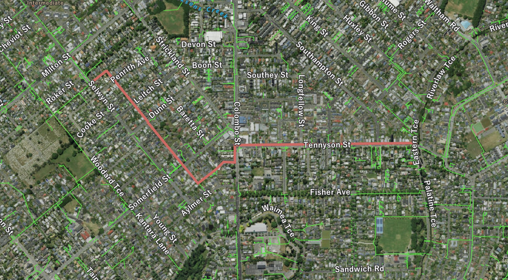
Tennysons Drain shown in red. the green lines are stormwater pipes. Click to enlarge

Where it joins the river

Img 2863
The outfall of Tennysons Drain on the downstream side of the bridge. Click to enlarge

About the waterway

One of the drains commissioned by the Christchurch Drainage Board, the longest section running the length of Tennyson Street is still a 900mm brick barrel construction.  Upstream of Colombo Street, the waterway has occasional open-air sections with a concrete half-round base.  The drain takes surface water from between the catchment of the Wilderness Creek and Jacksons Creek and conveys it to the river with the outfall on the downstream side of the bridge that carries Tennyson Street over the river.  There is generally a minimal flow in it probably due to parts of the catchment being just at or below the water table at times.

A view of the waterway

Img 2860
The first section of open-air channel commences on the side of Selwyn Street south of Roker Street - a stromwater pipe emerges into channel. Click to enlarge
Img 2861
A view of the channel as it heads off towards Penrith Avenue at the start of the open-air section. Click to enlarge
Img 2859
The waterway about to be piped beneath Leitch Street. Click to enlarge
Img 2858
The very unloved channel heads towards Dunn Street. Click to enlarge
Img 2857
The waterway emerges from under Somerfield Street and heads towards the commencement of 1.1km of brick barrel culvert that ends at the river. Click to enlarge

Historical maps

1930s
Drainage Board plan from late 1930s.. Click to view original.
1948
A street map dated to circa 1948 with the waterways that contribute to the river clearly marked. Click to enlarge