Sibleys Drain

Naming

Bowenvale Avenue is named because it runs through Bowenvale which, in turn, is named after Charles Bowen (1804‐1871). Bowen, an original land purchaser in 1850, bought Rural Section 82, 50 acres on the “south bank River Heathcote, foot of hills”. He was the first Speaker of the Canterbury Provincial Council but eventually returned to England.

The road is first mentioned in The Press in 1923 when it is reported that the Bowenvale Residents and Ratepayers Association had asked the Heathcote County Council to install drainage facilities along Bowenvale Avenue.

The drain obviously dates from after 1923.

Sibleymap
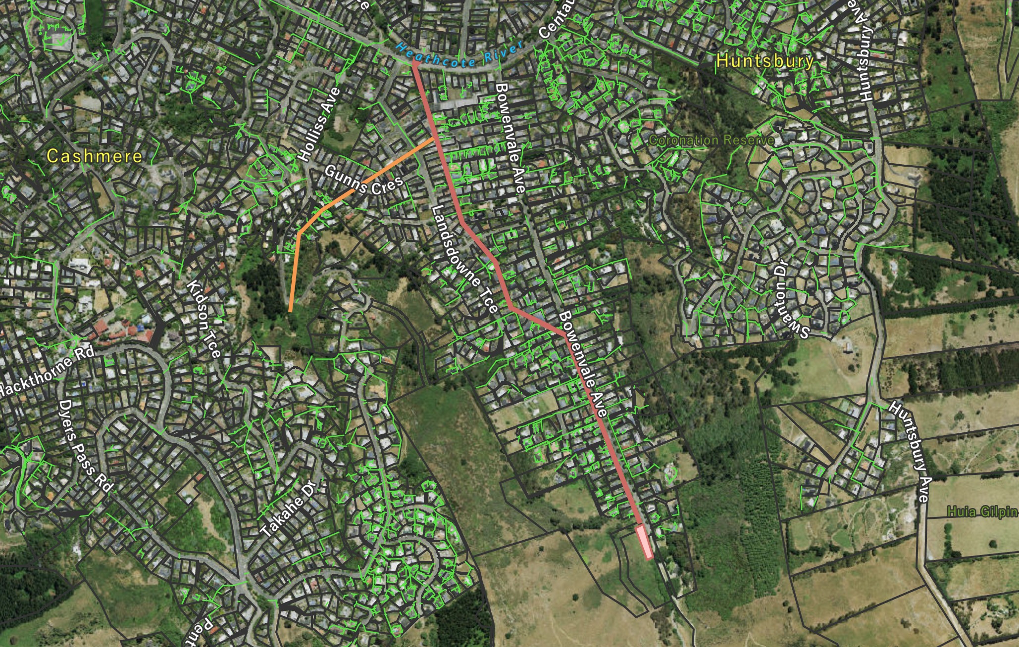
Sibleys Drain shown in red. Patchetts Drain shown in orange. Green lines are stormwater pipes. Click to enlarge

About the waterway

Above the large stormwater basin at the top of Bowenvale Avenue, the waterway is a natural, ephemeral stream in the Bowenvale Valley floor running beside the Valley Track and collecting the entire valley head stormwater.  From the stormwater basin to the river, located beside the road or between private property boundaries, the waterway is a deep, concrete-lined drain into which many stormwater pipes are directed. About 180m above Centaurus Road, Patchetts Drain joins Sibleys Drain and contributes a steady base spring-fed flow from the slopes above Holliss Reserve (but not from Holliss Reserve itself).  Sibleys Drain does not otherwise appear to be spring-fed.

The Bowenvale Valley catchment has been used extensively to develop hydraulic models for the river.  Click to read “CALIBRATION OF RUNOFF-ROUTING MODELS FOR THE PORT HILLS CATCHMENTS”

Historical map

1948
A street map dated to circa 1948 with the waterways that contribute to the river clearly marked. Click to enlarge

Where it joins the river

Img 2772
The more downstream of the two outfalls. Click to enlarge

There are two outfalls from Sibleys Drain into the Ōpāwaho Heathcote River, about 14m apart.  To cope with high volume events, the concrete drain divides into two culverts to pass beneath Centaurus Road.

Img 2773
This is the more upstream of the two outfalls and appears to require increased flow levels before being operative. Click to enlarge

A view of the waterway

Img 2761
At the top of Bowenvale Avenue is a stormwater reception basin to slow the flow of water in high rainfall events. The natural valley stream runs into this basin. There is no flow except as surface water runoff from the catchment area. Click to enlarge.
Img 2763
At the downstream end of the basin, the water is directed into the concrete channel. Click to enlarge
Img 2764
The channel as it departs the reception basin. There are a large number of stormwater pipes directed into this channel throughout its length. Click to enlarge
Img 2767
The waterway as it runs next to Bowenvale Avenue. Click to enlarge
Img 2769
The waterway turns away from Bownenvale Avenue and heads behind private properties towards Landsdowne Terrace. The large stormwater pipe joining of the right brings flow from Scotts Drain on the other side of Bowenvale Avenue. Click to enlarge
Img 2771
The waterway after exiting under Wedgewood Avenue. Click to enlarge
Img 2820
A view of the stream which flows into Patchetts Drain taking flow from the head of the valley above Holliss Avenue. Click to enlarge
Img 2821
Patchetts Drain as it pass beneath Hollis Avenue heading towards Sibleys Drain. Note the reasonable spring-fed flow. Click to enlarge
Img 2822
Patchetts Drain after emerging from teh culvert under Gunns Crescent. Click to enlarge
Img 2823
Patchetts Drain after emerging from under Landsdowne Terrace and about to enter Sibleys Drain. Click to enlarge
Img 2775
Grafitti adorns the concrete sides of the waterway soon after the Patchett Drain junction and directly before passing under Centaurus Road. Click to enlarge.