Popes Drain

Naming

The definitive reason for the naming of this waterway is not known but it is likely to have been named after a landowner C. E Pope who served as a Heathcote County Councillor 1945 – 1953.

Popemap
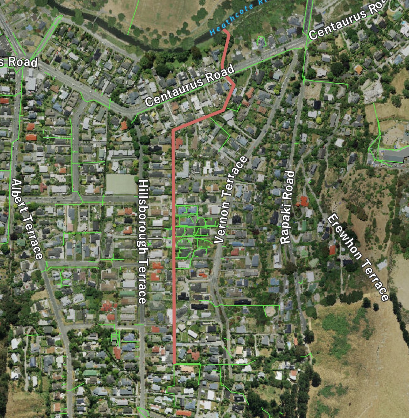
Popes Drain shown in red. The green lines are stormwater pipes. Click to enlarge

Where it joins the river

Img 2739
The outfall of Popes Drain passes under a footbridge behind the St Martins Scout Den. Click to enlarge

About the waterway

For much of its length, the waterway is a channel with wooden plank sides passing along the boundary between private properties approximately midway between Hillsborough Terrace and Vernon Terrace in the base of the valley.  As such, it likely follows much the same path as the original waterway.  The formed drain is likely to date from the 1920s but this has yet to be confirmed.  Its only really public manifestation is as a creek over which walkers pass on a footbridge as they enter or leave the King George V Reserve via the floodplain at the end of  Riverlaw Terrace.  The waterway has a low flow throughout the year.

A view of the waterway

Img 2872
A view of the waterway close to its highest point at the rear of 102 Vernon Terrace. Click to enlarge
Img 2871
Looking downstream for the previous view. Click to enlarge
Img 2867
Behind 80 Vernon Terrace, the waterway progresses through uncontained riverbanks. Click to enlarge
Img 2866
Just 20m downstream of the previous view, the wooden side recommence. Click to enlarge
Img 2749
The waterway emerges from a pipe under centaurus Road and moves through a bush area beside the St Martins Scout Den. Click to enlarge
Img 2751
The final run to the river is in a unsupported channel. Click to enlarge

Historical maps

1930s
Drainage Board plan from late 1930s.. Click to view original.
1948
A street map dated to circa 1948 with the waterways that contribute to the river clearly marked. Click to enlarge