Huntsbury Waterway

Naming

Dry Bush Road was the original for Huntsbury Avenue which was formed when the Huntsbury Estate was subdivided and sections sold in 1924.  The origin of the name Huntsbury is not known.

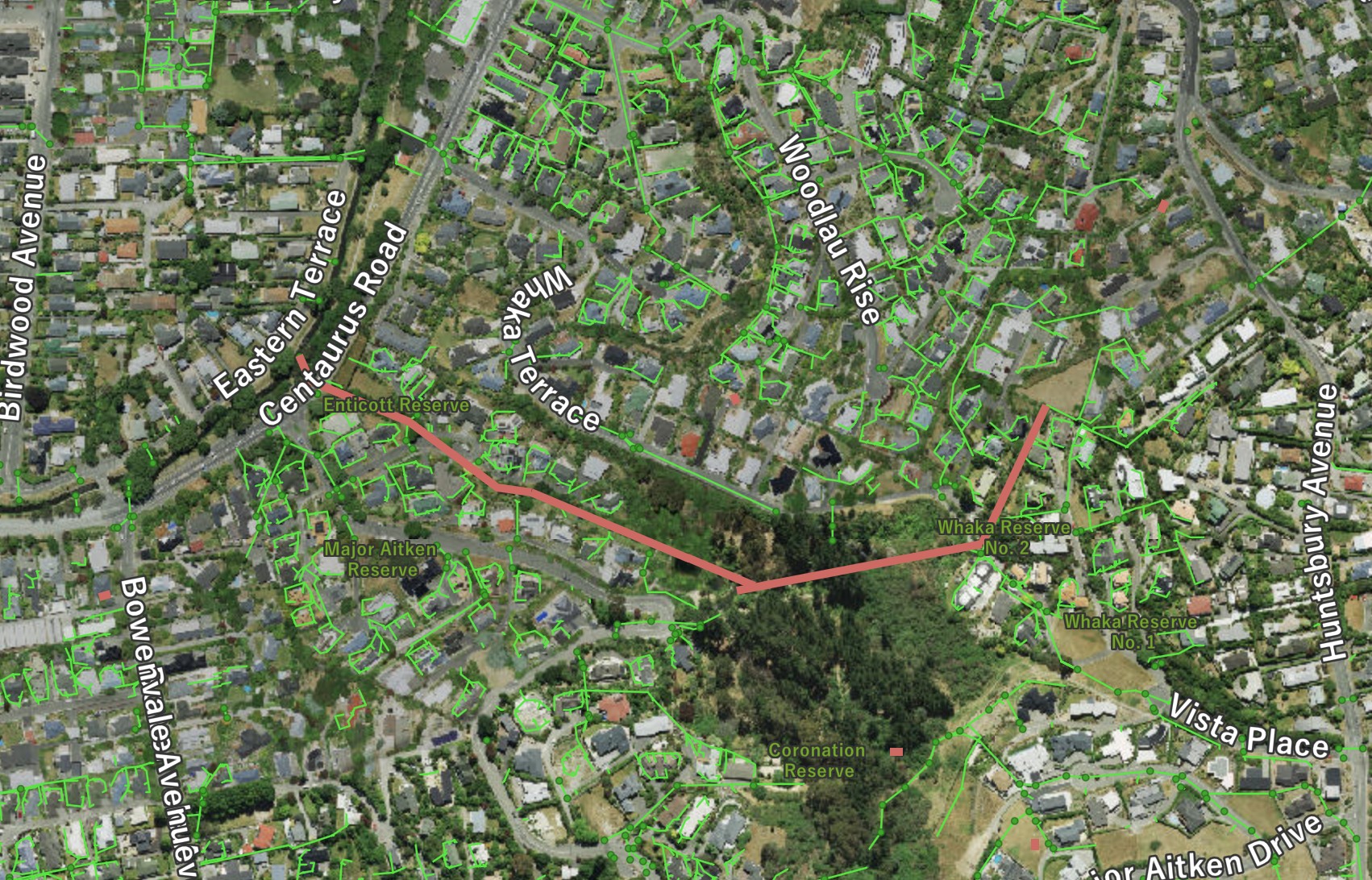
Huntsbury Waterwaymap
The Huntsbury Waterway is shown in red. The green lines are stormwater pipes. Click to enlarge

About the waterway

The Huntsbury Waterway drains from above Whaka Terrace and runs through Coronation Reserve where there are several features to slow the passage of stormwater.  The waterway is generally only a trickle except during rain events when it can flow quite significantly.  The waterway passes in a pipe under Enticott Place through Enticott Reserve, under Centaurus Road to the river, the outfall on the riverbank facing 57 Ashgrove Terrace.

Historical maps

1948
A street map dated to circa 1948 with the waterways that contribute to the river clearly marked. Click to enlarge

Where it joins the river

Img 2776
The confluence of the Huntsbury Waterway and the river. Fish friendly. Click to enlarge

A view of the waterway

Img 2846
The steep waterway as it passes through the top part of Coronation Reserve. Note the rocks to slow the rate (ineffective). This waterway leads to three artifical weirs. Click to enlarge
Img 2848
View of the constructed ponds and weirs through which the waterway passes. Click to enlarge
Img 2849
The waterway flows through this swale section of private land as it heads towards Enticott Place. Click to enlarge
Img 2849
The waterway flows through this swale section of private land as it heads towards Enticott Place. Click to enlarge