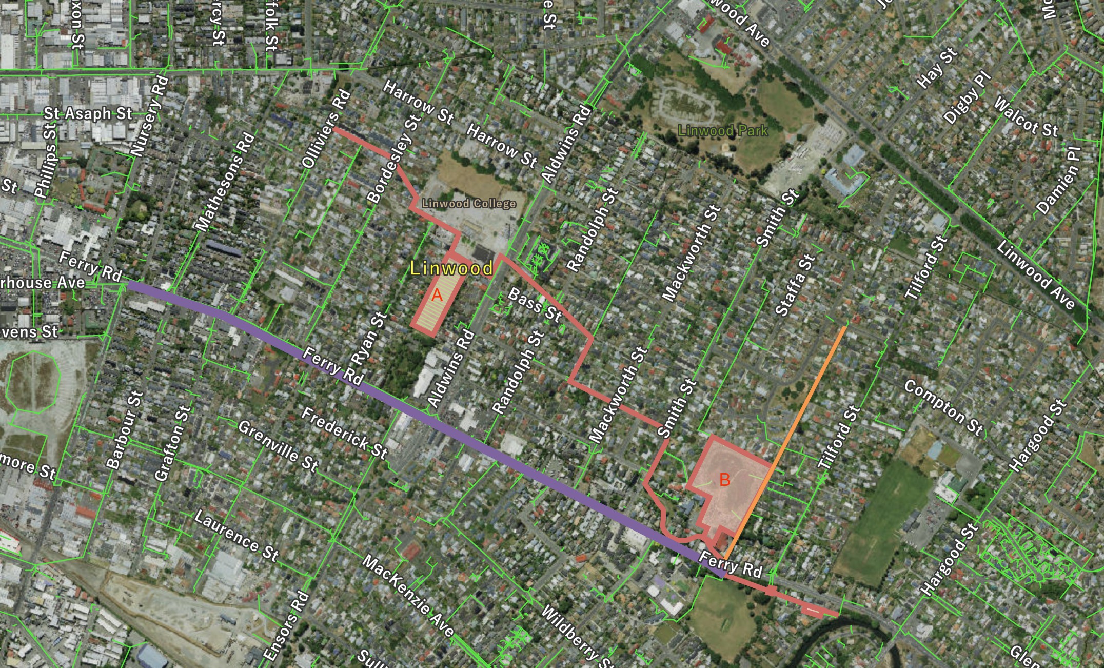
This waterway is probably named after William Bell who in 1855 took out a lease of unknown length and resided on 45 acres of land in the area that is now Te Oranga Waikura Urban Forest (previously Lower Linwood Fields) located at the lower end of Bells Creek between Smith Street and Tilford Street.
Bells Creek
About the waterway
This otherwise minor waterway has played a role in the drainage of Christchurch from the early days of the colonists – its outfall to the Ōpāwaho Heathcote River has been used as the convenient location for the outfall of major sewers. The creek, which currently exists only as a modified drain with concrete half-round base along most of its length, takes stormwater from much of residential Woolston. Its outfall at the Ōpāwaho Heathcote River is next to the site of the Christchurch Quay on the corner of Richardson Terrace.
Bells Creek is part of a flood reduction scheme implemented in 2018/2019. Towards the end of its run, Bells Creek picks up water from the Arran Drain (see below), passes under Ferry Road to join the Ferry Road stormwater sewer (see below). This combined stormwater flow then passes through a coarse debris screen at Woolston Park after which a portion enters a large stormfilter treatment device. A large 4m³/s stormwater pump station at Richardson Terrace then helps it reach the river. When activated, the pump raises the stormwater so that it can flow despite the height of the Ōpāwaho Heathcote River in flood.
Ferry Road Stormwater Sewer An open drainage ditch running largely parallel to and on the southern side of Ferry Road was built in the late 1850s by the provincial government in order to remove water from the swampy southern part of Christchurch. Its outlet was into the Ōpāwaho Heathcote River via the final part of Bells Creek. This open drain was replaced by the construction of the Ferry Road stormwater brick barrel sewer that began in October 1878 and was completed in late June 1879. This large drain is still operative (as above) although sections totalling 59m (2.6% of total length) were replaced following the 2011 earthquake sequence. The catchment of this drain is approximately 160 hectares of commercial/residential land types and includes all flows draining from Ferry Road, Moorhouse Avenue, Fitzgerald Avenue and part of the CBD.
Edmonds Park retention basin As Bells Creek passes through Te Aratai (Linwood College) grounds, it picks up pumped groundwater from beneath the recently created Edmonds Park basin. This basin, which in fine weather boasts two soccer fields, retains stormwater to a depth of 1m to reduce the flow of Bells Creek during high rainfall. For a more detailed description of this facility, click here
Te Oranga Waikura Urban Forest retention basin Similarly, what used to be called the Linwood College Lower Fields but is now called the Te Oranga Waikura Urban Forest, forms a further retention pond to take the peak of stormwater flow in the creek. When the main Bells Creek channel which has 40 ha of largely impervious catchment, backs up in a flood, it will start spilling into the basin through a weir and inlet pipe from Smith Street down Bray Street to the basin. The first flush/base flow does not enter the basin, it continues down Bells Creek, and instead the basin takes the storm volume from the top of the hydrograph. The basin also takes backed up flow from the Arran Drain and returns the water from the basin to Bells Creek through Arran Drain. For a more detailed description of this facility, click here
Filter station The Bells Creek filter station is New Zealand’s largest proprietary treatment device. The filter is composed of 570 StormFilter™ cartridges installed in a vault 18.9m x 12.6m. The treatment flow through each cartridge has been reduced to half of its maximum treatable flow rate to promote sediment settlement and to increase the contact time between the active media and the contaminants of concern, particularly heavy metals. With each cartridge treating 0.79 L/s, the installed treatment system can treat up to approx. 450 L/s. This system, activated in 2019, is maintained by CityCare.


