Scotts Drain

Naming

While the actual naming is unknown, it is likely that the waterway was named after John Flinders Scott who owned a considerable portion of the Port Hills along with a sheep station at Parnassus, a large orchard at Chaneys, an apiary at Broadfield and a 25 acre holding at Opawa that included his house Hawford on what is now Hawford Road.  Scott was also a Heathcote County councillor 1926 – 1941.  It is entirely possible that Scott himself contracted for the drain to be dug on his property to improve it.

An alternative would be that it is named after George Scott, a prominent Christchurch businessman who was chairman of the Heathcote Road Board 1905 – 1911 and chairman of the Heathcote County Council 1911 – 1916.

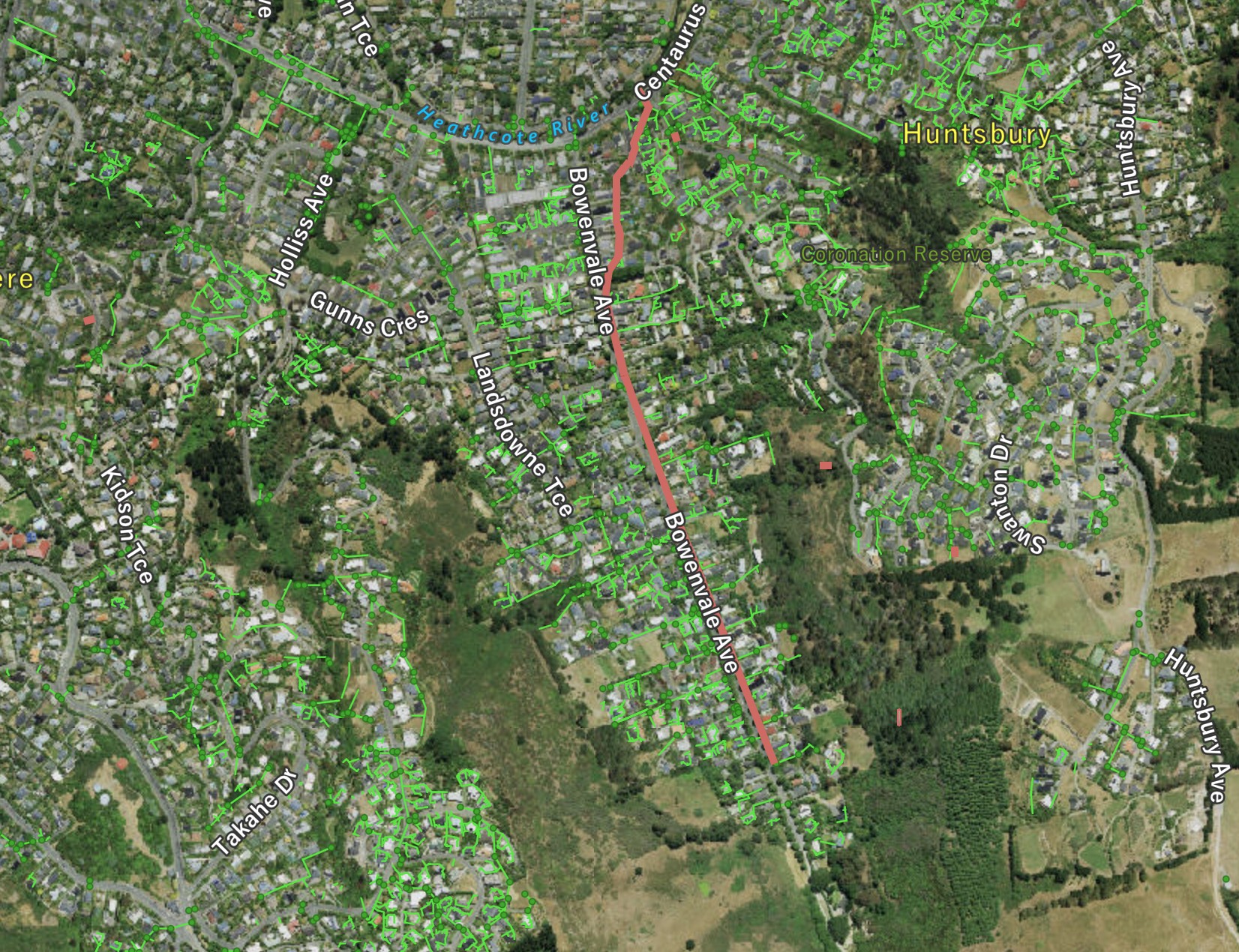
Scottsmap
Scotts Drain shown in red. Click to enlarge

About the waterway

The original waterway was converted into a formed drain sometime around 1874. The drain follows much the same route as the original waterway. It is principally a stormwater drain but it picks up a small flow from seeps.

It has been piped, straightened, modified and repaired considerably over the intervening years. For most of its length, where the waterway is open to the air, it is a wooden-sided or concrete-sided trough that would have been hand-dug to efficiently drain the land on the eastern side of Bowenvale Avenue and the slopes above.  Much of the drain has been replaced by pipes.

From 23 Bowenvale Avenue, the waterway cuts through between private properties to the bottom of Major Aitken Drive where is received into a small, deep trench before it is piped under Centaurus Road to the river.

Historical maps

1948
A street map dated to circa 1948 with the waterways that contribute to the river clearly marked. Click to enlarge

Where it joins the river

Img 2776
The confluence of the Huntsbury Waterway and the river. Fish friendly. Click to enlarge

A view of the waterway

Img 2765
The uninviting first appearance of the waterway near the top of Bowenvale Avenue. Above here it is piped. Click to enlarge
Img 2766
The first of the open-air sections of the drain near the top of Bowenvale Avenue. Click to enlarge
Img 2760
There are a few sections where the wood sides have been upgraded to concrete. This is halfway down Bowenvale Avenue. Click to enlarge
Img 2759
A combo concrete wall and wooden plank treatment for the waterway outside 39 Bowenvale Avenue. Click to enlarge
Img 2758
The waterway just as it starts to veer away from Bowenvale Avenue towards Major Aitken Drive. Click to enlarge
Img 2824
The last sight of the waterway before it heads into a pipe to Major Aitken Drive. Click to enlarge